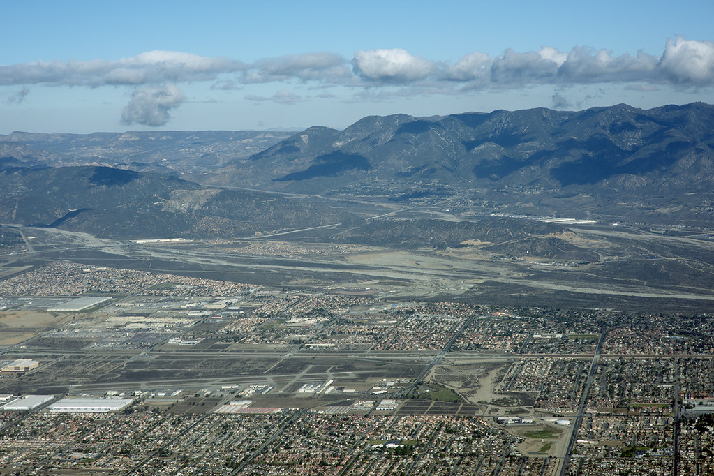
Aerial view of Devore, San Bernardino County, California by Michael Rymer
Aerial photograph of the San Andreas
Fault (extending along the change in slope along the San Bernardino
Mountains, in distance, to the right), Devore, San Bernardino County,
California. Included in this view to the northwest are Lyttle Creek (in
mid-ground), Cajon Wash (in mid-distance), and the Rialto Airport (left
foreground). I-15 cuts diagonally across the left side of image to where
it meets and joins I-215. This image shows the epicentral area of a
recent swarm of earthquakes near Devore.
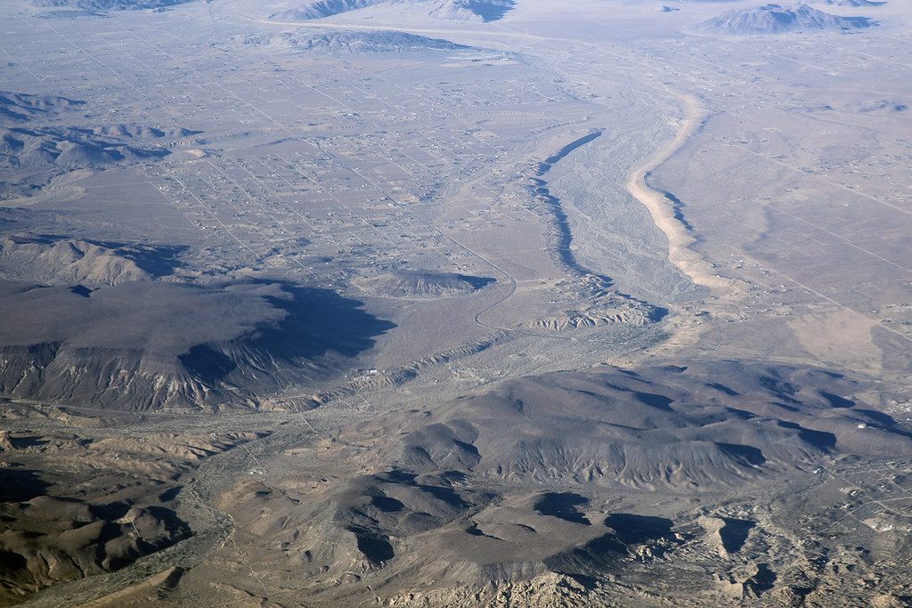
Aerial view of Pipes Wash and Landers, San Bernardino County, California by Michael Rymer
Aerial photograph of Pipes Wash and
Landers, San Bernardino County, California. Just beyond the flat,
basalt-topped mesas in this view is the Johnson Valley Fault, which
along with several other faults, ruptured during the 1992 Landers
earthquake. The Johnson Valley Fault extends from about 3 o'clock to
about 10 o'clock; surface faulting associated with the 1992 earthquake
ruptured along multiple faults across the valley near the upper left in
this view to reach the Homestead Valley Fault, which also slipped in the
earthquake. The constriction in Pipes Wash near the center of the
image, is controlled by slippage of the Johnson Valley Fault. View to
the northeast.