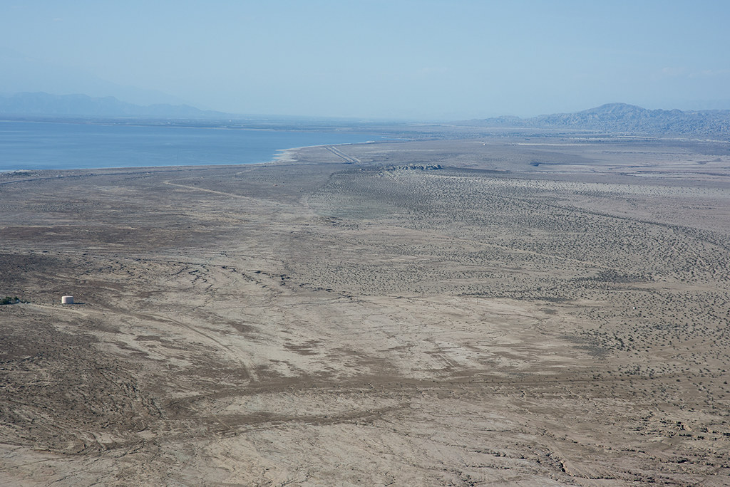
Aerial view of the San Andreas Fault, Durmid Hill, Imperial County, California by Michael Rymer
Aerial photograph of the San Andreas Fault (extending from approximately 7 o'clock to near the center of the image, at Bat Cave Buttes and Salt Creek), Durmid Hill, Imperial County, California. The Durmid Hill area was below the high stand of Ancient Lake Cahuella until that lake began to evaporate, in about the 1680s. The erosive wave action of the receding lake shoreline removed almost all soil and other surface cover, resulting in this stark geologic setting. View to the northwest, with the Salton Sea toward the left background.

No comments:
Post a Comment